Mandate Order Terrain and Resources
Classify frontier tiles for water, food, industry, and defense before peasants commit to the wrong district.
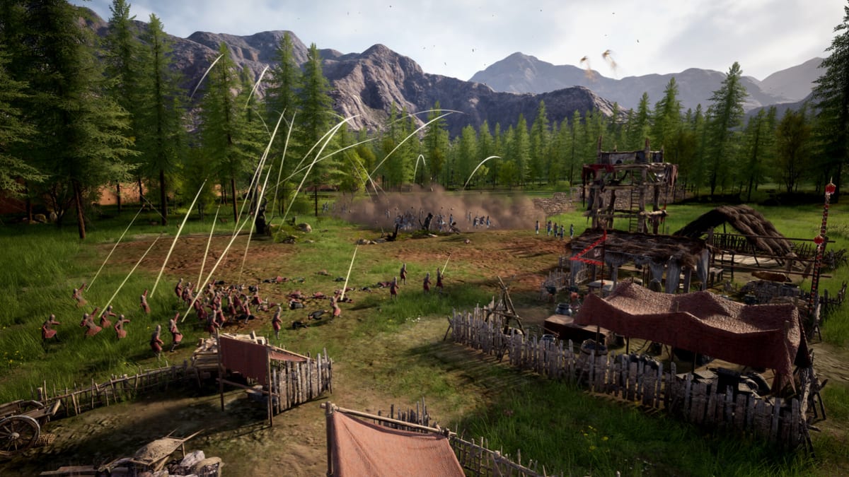
Mandate Order maps present a Warring States frontier where survival depends on reading terrain before placing prestige structures. Digital Sky’s freeform builder lets you erect walls and workshops on many slopes, but peasants still walk real paths and farms still obey seasons. A beautiful hilltop palace means little if ore sits across a river without a freight plan, or if autumn harvest cannot reach a granary on the wrong bank. This guide teaches a tile survey method you can repeat on the launch map and on future Early Access layouts promised in roadmap posts.
Pair map reading with camera and construction so you inspect tiles at district zoom, not only minimap color. Pair resource plans with production chains and how to manage logistics so local stockpiles become armies instead of decorative piles.
Step one: mark water and habitability
Freshwater anchors the opening hour. Scan for:
- River bends with easy well access for housing clusters.
- Lakes or ponds that shorten haul routes for laundry, ritual, or future industry depending on patch content.
- Dry ridges suitable for towers later but poor for early wells unless you invest extra labor.
Place mental A/B banks on rivers. Housing on one bank and farms on the other is valid only if roads, bridges, or ferry logic shown in your build support cross-bank freight cheaply. Otherwise pick one core bank for the first season.
Cross-read getting started for well-first sequencing.
Step two: classify arable land and seasonal risk
Mandate Order uses four-season agriculture with weather feedback—not abstract infinite food. When surveying fields:
- Favor broad flat floodplain for consistent worker reach.
- Avoid slicing fields into thin strips separated by cliffs; each strip becomes its own courier problem.
- Note north-facing slopes or shaded basins that may slow spring planting in some maps.
- Reserve expansion corridors for second-year farms before you wall them off accidentally.
How to farm by season explains planting and harvest cadence once tiles are chosen.
Step three: timber, stone, and ore pockets
Industrial chains begin at map features, not menus. Walk the frontier marking:
- Forest clusters for fuel, construction timber, and tool inputs.
- Stone outcrops for walls and siege repairs shown in walls and siege.
- Ore veins for weapons-grade metal feeding workshops and armories.
For each pocket, ask: Can a warehouse sit within practical courier range of both the extractor and the workshop district? If ore is gorgeous but isolated, either plan a dedicated mining camp with its own freight spine or defer mining until roads catch up—do not pretend global inventory will save you.
Step four: elevation, sight lines, and combat value
Preview hands-on reports highlight elevation affecting archer effectiveness. When surveying:
- Tag high ground near expected invasion roads for towers and archer platforms.
- Tag dead ground where melee can approach under cover—plan shorter inner walls or reserve cavalry sally lanes.
- Note cliff edges that channel enemies into chokepoints favorable for wedge formations from formations and line drawing.
Elevation matters at build time. Moving a tower after discovering a blind approach wastes stone and labor.
Step five: disasters and special tiles
Store copy and previews mention natural disasters—floods, droughts, plagues, and rare events such as meteor impacts yielding star iron for advanced weapons in later progression. During survey:
- Flag floodplains that boost farm yield but risk disaster loss.
- Flag narrow valleys where disease might spread quickly between dense housing you planned for efficiency.
- Treat exotic event tiles as long-term goals, not day-one dependencies.
Adjust retainers and policies using how to recruit retainers when disaster pressure rises.
Resource categories and logistics behavior
Remember Mandate Order’s non-global economy while labeling tiles:
| Resource family | Typical map feature | Logistics note |
|---|---|---|
| Food | Arable flats near water | Seasonal harvest → granary pull range |
| Fuel | Forests, charcoal workshops | Winter satisfaction demand |
| Construction | Timber, stone | Road-heavy hauling before walls |
| Military metal | Ore, special event iron | Workshop → armory → conscription |
| Trade goods | Road-linked clearings | Diplomacy and market structures |
Warehouses must sit where couriers can bridge gaps between these families. See warehouses and storage.
Terrain mistakes that look like bugs
- Workshop “missing ore” when ore exists on an unconnected hillside.
- Starvation with full fields when granaries sit off the farm bank without freight.
- Empty armories when weapons stockpile in a general warehouse outside barracks range.
- Siege loss with archers idle because towers lack elevation on the threatened face.
Fix terrain and roads before filing bug reports.
Future maps and biome shifts
Roadmap teasers promise maps emphasizing different survival pressures—scarce water, harsh winters, sparse ore, or aggressive invasion vectors. When new biomes arrive, rerun this five-step survey instead of copying frontier layouts verbatim. Starting stronghold tips adapts the survey into a week-one plan.
Survey checklist you can screenshot
- Core bank chosen with well sites circled.
- Farm expansion zones marked away from future wall lines.
- Forest, stone, and ore tagged with planned warehouse hubs.
- High ground and chokepoints labeled for towers and gates.
- Disaster-risk tiles noted with mitigation plans (fuel reserves, hospital roadmap content, etc.).
- Road spine sketched mentally from extractors to armory district.
Community tools may later formalize this checklist; handwriting on a map screenshot works today.
Connecting terrain to diplomacy and expansion
Maps are not only defense puzzles. Flat corridors also become trade roads and diplomatic arteries as titles and neighbors matter mid-game. Over-walling your only gentle approach may secure sieges while strangling caravans—balance outward expansion using guides strategic overview.
Terrain reading is the cheapest optimization in Mandate Order. Ten minutes of labels saves ten hours of courier firefighting—and makes combat guides about formations and siege engines worth reading instead of rage-quitting.
Frequently Asked Questions
Quick answers drawn from Early Access systems and common player questions.
Can I farm on hills in Mandate Order?
Freeform build allows many placements, but flat arable tiles produce fewer logistical headaches. Prefer floodplain fields until freight is mature.
How far can couriers haul resources?
Range is building-specific and pull-based, not global. Survey tiles with planned warehouses between extractors and workshops.
Do rivers block invasions?
Rivers shape approach paths but do not automatically stop armies. Pair water features with walls, towers, and formations at chokepoints.
What is star iron on the map?
Previews tie rare star iron to late disaster events for advanced weapons. Treat it as a long-term map objective, not an Early Access day-one need.
Where do I go after labeling terrain?
Apply labels in starting stronghold tips, then execute opening build order.